















May 22th 2023
The Thônes Cœur des Vallées territory extends from Mont Charvin to the Glières plateau, passing through Parmelan, Tournette, Sulens, Plateau de Beauregard, Pointe de Talamarche, Dents de Lanfon… and includes no less than 7 mountain refuges.
We advise you to book your mountain huts in advance (some are not open every day). Most huts are normally open from the end of May to September (check with the huts directly or the Tourist Office for exact dates, see the end of the article).
Note: the sites of the Massif de la Tournette , the Plateau de Beauregard , and the Chaîne des Aravis are classified Natura 2000 sites. Natura 2000 aims to preserve biological diversity in Europe by ensuring the protection of exceptional natural habitats as such or as necessary for the conservation of animal or plant species.
| Summer 2026: This summer, exceptionally, the mountain huts of Alpage du Freu and Praz D'Zeures will be closed. |
Sharing the mountain: encountering the herds
During your trek between our mountain huts, you'll have the chance to cross vibrant alpine pastures, shaped by the work of shepherds and their flocks. To ensure this shared experience remains enjoyable, a few simple guidelines are essential. If you encounter a livestock guardian dog (like the famous Pyrenean Mountain Dog), don't be surprised: it's simply doing its job! When approaching, keep your distance, remain calm, don't shout, and avoid sudden movements. The dog is simply identifying you before allowing you to continue on your way. By respecting this "sharing of the mountains" and the work of the shepherds, you help preserve the balance of our valleys and the tranquility of the local wildlife.
To best prepare for your stage and anticipate the presence of herds on your route, we advise you to consult the interactive map MapPatou.
hiker's charter, adopt the right actions
- Let's stay on the trails
- Let's close the fences and barriers
- Let's keep dogs on leashes
- Let's collect our waste
- Let the flowers grow
- Let's be discreet
- Let's not make a fire
- Leave the animals alone
- Let's respect other users
- Let's keep the water points clean
CONTENTS
- 2 days / 1 night : Parmelan Refuge
- 2 days / 1 night : Talamarche Point – Larrieux Refuge
- 2 days / 1 night : Praz d'Zeures Shelter
- 2 days / 1 night : Lindion Refuge
- 2 days / 1 night : Charvin Lake – Marlens pasture / Freu mountain pasture / Les Fontanettes
- 3 days / 2 nights : Dingy-Saint-Clair – Parmelan – Glières Plateau – Morette
- 3 days / 2 nights : The Bouchet-Mont-Charvin – Charvin – Freu – The Bouchet-Mont-Charvin
- 4 days / 3 nights : Thônes – Praz d'Zeures (closed summer 2026) – Charvin – Le Bouchet-Mont-Charvin
- 4 days / 3 nights : Dingy-Saint-Clair – Parmelan – Glières Plateau – Talamarche – Alex
2 day / 1 night itinerary suggestions
1) Parmelan Refuge
Superb hike accessible by roaming via the Parmelan refuge which offers a panoramic view of the Aravis and Mont Blanc.
Grand Montoir: cable passage, not recommended for people prone to vertigo.
Camille Dunant Refuge – Parmelan : 06 16 85 58 81
Day 1: Distance: 4,8 km, Elevation gain: 900m, Elevation loss: 45m, Duration: approximately 3 hours
Day 2: Distance: 6 km, Elevation gain: 110m, Elevation loss: 900m, Duration: approximately 2h30
Getting There :
Park in the Blonnière car park, commune of Dingy-Saint-Clair.
2) Pointe de Talamarche – Larrieux Refuge
Nice loop to reach the summit of the Pointe de Talamarche while sleeping one night at the Refuge de Larrieux.
Larrieux Refuge : 06 16 85 58 81
Day 1: distance: 3,5 km, elevation gain: 740m positive elevation gain, 25m negative elevation gain, duration: approximately 2h15.
Day 2: distance: 7,5 km, elevation gain: 370m positive elevation gain, 1080m negative elevation gain, duration: approximately 3h15.
Getting There :
Park in the Montremont car park, commune of Thônes.
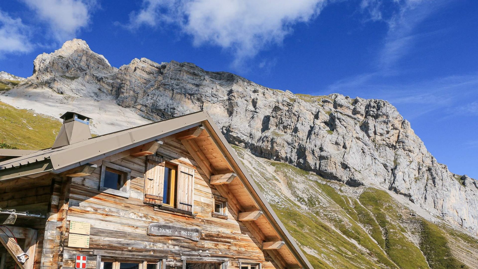
3) Praz d'Zeures Refuge (closed summer 2026)
On the eastern face of the Tournette massif in Haute Savoie, the Praz D'zeures mountain pasture belongs to the commune of Serraval. It has kept its old name which means the meadow (Praz) of the mountain pasture located two hours (D'zeures) walk from the nearest village. In fact, this is the average walking time it takes you to reach the refuge from the Molloire car park.
After a night at the refuge, the next morning, continue the hike by going around the Aiguille de Serraval and return to the start, at the Molloire car park.
Praz d'Zeures Refuge : 06 25 88 52 61 (closed summer 2026)
Day 1: distance: 4 km, elevation gain: 710m, duration: approximately 2h30.
Day 2: distance: 7km, elevation gain: 225m positive elevation gain, 930m negative elevation gain, duration: approximately 2h45.
Getting There :
Park in the Molloire car park, in the commune of Serraval.
4) Lindion Refuge
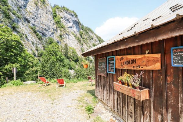
Rémi welcomes you at 1100m altitude in a quiet and isolated setting to sleep and/or eat. This alpine chalet between lake and mountain is on the GR 96 and GRP Tournette Aravis route and many other family hikes.
The Refuge du Lindion is open continuously from the beginning of June to the beginning of September, to also keep the cows of the mountain pasture. The rest of the year by reservation. It is accessible in 1h30 from the Morette car park.
Lindion Refuge : 09 70 03 04 44
Day 1: distance: 3,3km, elevation gain: 575m positive elevation gain, 35m negative elevation gain, duration: approximately 2 hours.
Day 2: distance: 3,3km, elevation gain: 35m positive elevation gain, 575m negative elevation gain, duration: approximately 1h15.
Getting There :
Park in the Morette car park, in the commune of Thônes.
5) Lake Charvin – L'Aulp de Marlens / l'Alpage du Freu (closed summer 2026) / l'Auberge des Fontanettes
Here is a sporty loop route that will allow you to discover one of the wonders of the Thônes Cœur des Vallées region, Mont Charvin!
To spend the night, 3 possible options: the Alpage du Freu, the Auberge des Fontanettes or the Aulp de Marlens.
Freu Passage not recommended for people prone to vertigo.
Aulp de Marlens : 06 16 85 58 81
Freu mountain pasture : 06 16 85 58 81 (closed summer 2026)
The Fontanettes : 06 83 03 16 35
Day 1 (towards Aulp de Marlens): distance: 3 km, elevation gain: 310m, elevation loss: 35m, duration: approximately 1 hour 15 minutes
Day 1 (towards the Freu Alpine pasture, via Lake Charvin): distance: 9km, elevation gain: 930m, elevation loss: 630m, duration: approximately 4h20
Day 1 (towards Les Fontanettes): distance: 2km, elevation gain: 130m, elevation loss: 35m, duration: approximately 40 minutes
Day
Getting There :
Park in the Sardoches car park, commune of Bouchet-Mont-Charvin.
3 day / 2 night itinerary suggestions
1) Dingy-Saint-Clair – Parmelan – Glières Plateau – Morette
Magnificent hiking tour passing by the Tête du Parmelan which offers a panoramic view of the Aravis and Mont Blanc. The Plateau des Glières, a high place of memory of the Resistance is also a Sensitive Natural Area which is home to remarkable fauna and flora.
Day 1 Dingy-Saint-Clair – Petit Montoir – Camille Dunant Refuge (Parmelan): distance: 9km, elevation gain: 1435m, elevation loss: 215m, duration: approximately 5 hours
Day 2 Camille Dunant Refuge (Parmelan) – Ablon – Les Mangeurs de Lune Refuge : distance: 15,5km, elevation gain: 810m, elevation loss: 885m, duration: approximately 6 hours
Day 2 Camille Dunant Refuge (Parmelan) – Ablon – Chez Constance : distance: 16km, elevation gain: 470m, elevation loss: 870m, duration: approximately 5h15
Day 3: Refuge des Mangeurs de Lune – Dran – Pont de Morette: distance: 12km, elevation gain: 45m, elevation loss: 1220m, duration: approximately 3h25
Day 3: At Constance's – Dran – Pont de Morette: distance: 12,5km, elevation gain: 120m, elevation loss: 950m, duration: approximately 3h40
******
On the Glières Plateau, 2 accommodation options:
- Refuge Les Mangeurs de Lune (Plateau des Auges – Faucigny-Glières): by reservation, open only in summer. 04 50 22 47 22.
- At Constance (Faucigny-Glières): dormitories available, by reservation. 04 50 22 45 61.
Getting There :
The centre of the village of Dingy-Saint-Clair is accessible all year round by bus from Annecy or Thônes. A bus stop is located near the Pont de Morette where buses run all year round between Annecy and Thônes (line 62-63).
2) Le Bouchet-Mont-Charvin – Charvin – Freu – Le Bouchet-Mont-Charvin
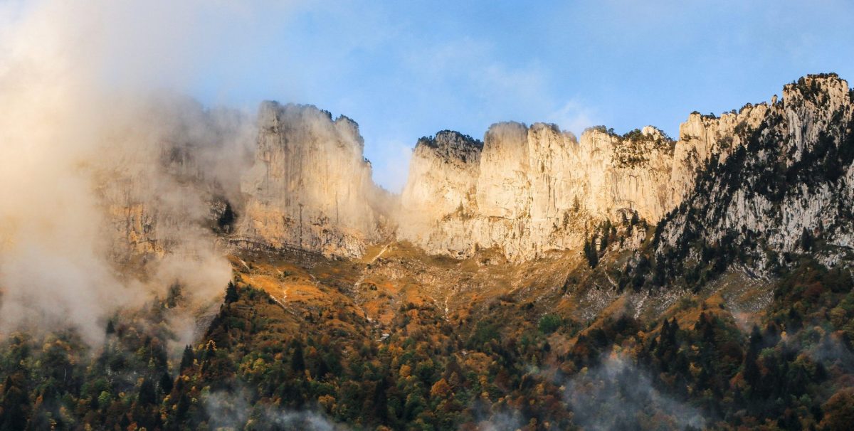
Beautiful loop starting from the village of Bouchet-Mont-Charvin, evolving between the Sulens mountain and Mont Charvin, with the highlight being the Charvin lake and the view of the Mont Blanc massif.
This loop can also be done from the village of Serraval. If you want to extend this route a little and go to the summit of Sulens, a departure from the Col de Plan Bois is possible.
Day 1: Le Bouchet-Mont-Charvin – Refuge de l'Aulp de Marlens OR Les Fontanettes : distance: 5km, elevation gain: 740m, elevation loss: 10m, duration: approximately 2h30
Day 2: Aulp de Marlens Refuge OR Les Fontanettes – Freu Alpine Pasture (closed summer 2026): distance: 3km, elevation gain: 200m, elevation loss: 180m, duration: approximately 1h10
Day 3: Freu Alpine Pasture – Le Bouchet-Mont-Charvin / Serraval: distance: 5,5km, elevation gain: 10m, elevation loss: 750m, duration: 1h40
******
Variant via the Plan Bois pass:
Day 1: Plan Bois – Sulens summit – Col de la Botte – Les Pézières – Aulp de Marlens refuge OR Les Fontanettes: distance: 11km, elevation gain: 600m, elevation loss: 240m, duration: approximately 4 hours
Day 2: Aulp de Marlens Refuge OR Les Fontanettes – Freu Alpine Pasture (closed summer 2026): distance: 3km, elevation gain: 200m, elevation loss: 180m, duration: approximately 1h10
Day 3: Freu Alpine Pasture (closed summer 2026) – Les D'zeures – Plan du Tour – Bois Noir – Plan Bois: distance: 11km, elevation gain: 240m, elevation loss: 630m, duration: approximately 3h30
Getting There :
Bouchet-Mont-Charvin and Serraval are accessible by shuttle only in summer.
4 day / 3 night itinerary suggestions
1) Thônes – Praz d'Zeures – Charvin – Le Bouchet-Mont-Charvin
Superb route on the foothills of the Tournette and at the foot of Mont Charvin passing by its high-altitude lake.
Day 1: Thônes – Praz d'Zeures Refuge: distance: 12,5km, elevation gain: 1400m, elevation loss: 220m, duration: approximately 6 hours
Day 2: Praz d'Zeures Refuge – Les Fontanettes OR Aulp de Marlens Refuge: distance: 16km, elevation gain: 1020m, elevation loss: 1150m, duration: approximately 6h30m
Day 3: Day 2: Aulp de Marlens Refuge OR Les Fontanettes – Freu Alpine Pasture (closed summer 2026): distance: 3km, elevation gain: 200m, elevation loss: 180m, duration: approximately 1h10
Day 4: Freu Alpine Pasture – Le Bouchet-Mont-Charvin: distance: 5,5km, elevation loss: 750m, duration: approximately 1 hour 40 minutes
Getting There :
The return Le Bouchet-Mont-Charvin > Thônes by shuttle is only possible in summer.
2) Dingy-Saint-Clair – Parmelan – Glières Plateau – Talamarche – Alex
Magnificent loop route passing through Parmelan, the Plateau des Glières and the Pointe de Talamarche. Numerous viewpoints over Lake Annecy, the Aravis, Mont Blanc and the Tournette.
Day 1: Dingy-Saint-Clair – Petit Montoir – Camille Dunant Refuge (Parmelan): distance: 9km, elevation gain: 1430m, elevation loss: 200m, duration: approximately 5 hours
Day 2: Camille Dunant Refuge (Parmelan) – Ablon – Chez Constance : distance: 16km, elevation gain: 470m, elevation loss: 870m, duration: approximately 5h15
Day 3: Refuge des Mangeurs de Lune OR Chez Constance – Dran – Pont de Morette – Refuge du Lindion OR Refuge de Larrieux : distance: 16km, elevation gain: 700m, elevation loss: 1000m, duration: approximately 5h30
Day 4: Lindion Refuge OR Larrieux Refuge – Pointe de Talamarche – L'Aulp Riant – Alex: distance: 12km, elevation gain: 750m, elevation loss: 1250m, duration: approximately 5 hours
Getting There :
Alex and Dingy-Saint-Clair are accessible all year round by bus (Thônes-Annecy line).

Contact details & information for shelters:
Camille Dunant (Parmelan – Dingy-Saint-Clair): 06 16 85 58 81
Lindion (Talamarche – Balme-de-Thuy): 07 86 50 64 92
Larrieux (Talamarche – Montremont): 06 16 85 58 81
Aulp de Marlens (Charvin – Bouchet-Mont-Charvin): 06 16 85 58 81
Les Fontanettes (Charvin – Bouchet-Mont-Charvin): 06 83 03 16 35
Alpage du Freu (Charvin – Bouchet-Mont-Charvin): 06 16 85 58 81 (closed summer 2026)
Praz d'Zeures (Tournette – Serraval): 06 25 88 52 61 (closed summer 2026)
You may also like...